Waterford's layered history, from its Viking foundations to its Victorian expansion and modern North Quays development, creates a fascinating subsoil puzzle beneath the city. The original settlement rose on elevated ground between the Suir and John's River, where stiff glacial till provided a natural fortress, but as the city spread south into the alluvial plains, the ground became far less predictable. At our team, we have seen how this transition from competent boulder clay to soft, compressible silts catches many developers off guard. A thorough soil mechanics study is not just a regulatory box to tick for the Building Control Amendment Regulations; it is the difference between designing foundations that will serve for a century and dealing with differential settlement that appears within five years. The Suir's tidal reach, extending well past Rice Bridge, also means groundwater chemistry here can be aggressive to concrete, a detail that only local experience tends to flag early in the design phase. Before breaking ground on any site near the river, we often recommend integrating field data with a CPT test to map the precise depth of the more competent bearing strata beneath the estuary muds.
Waterford's ground tells a story of ice, river, and tide; reading that story correctly through a soil mechanics study prevents a building from writing an expensive sequel.
Technical details of the service in Waterford
Demonstration video
Local geotechnical conditions in Waterford
One practical observation from our work across the Suir Valley is that the boundary between the boulder clay and the alluvial deposits is never a clean horizontal line. We often find a transitional zone of soft, laminated silty clay that has been reworked by post-glacial flooding. When a site investigation stops at the first refusal on a gravel layer, this transitional material can be mistaken for competent bearing soil, leading to unexpected long-term settlement of shallow foundations. The risk is amplified in the Ferrybank area, where the river has historically migrated, leaving buried channels of loose saturated sand that are highly susceptible to liquefaction under seismic loading. While County Waterford is classified as a low to moderate seismicity region, the amplification effects in deep soft soil basins can still generate damaging strains on piled foundations. A comprehensive soil mechanics study therefore includes cyclic triaxial testing on any loose saturated sands recovered from depths of less than 10 metres, a precaution too often omitted in cost-driven investigations.
Our services
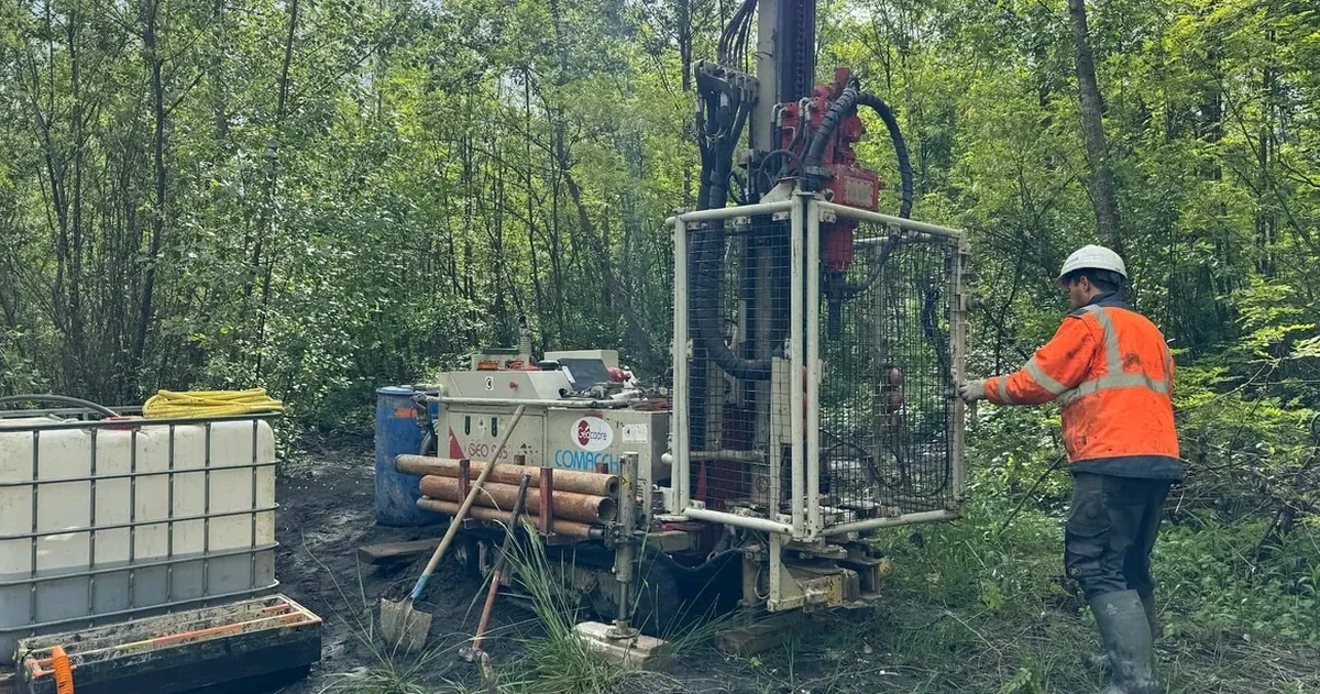
Our Waterford soil mechanics study is structured to support every stage of the project lifecycle, from a site's acquisition due diligence through to the final certification of compacted fill. We operate an INAB-accredited laboratory in the southeast, which means turnaround times for advanced testing stay within a week, not a month, keeping your enabling works on programme.
Foundation Design Parameter Assessment
We derive characteristic values for bearing capacity and settlement analysis using a combination of triaxial CIU/CAU tests, one-dimensional consolidation, and in-situ SPT correlations calibrated to the local Waterford geology.
Aggressive Ground Evaluation
Chemical analysis of soil and groundwater samples to determine sulfate, chloride, and pH levels, enabling specification of the correct Design Sulfate Class and concrete mix in accordance with IS EN 206 and BRE SD1.
Earthworks Suitability and Specification
Moisture condition value (MCV), chalk crushing value, and particle size distribution testing to classify site-won material for reuse as general fill, reducing off-site disposal costs and imported aggregate requirements.
Questions and answers
What is the typical cost range for a soil mechanics study on a residential site in Waterford?
For a standard single-dwelling investigation including site walkover, trial pits or window sampling, laboratory classification, and a factual report with foundation recommendations, the fee typically falls between €2,560 and €4,120, depending on access constraints and the number of samples requiring advanced strength testing.
How deep should a site investigation go for a two-storey extension on the south side of the city?
In Waterford's southern suburbs, where glacial till is often within two to three metres of the surface, we generally recommend advancing boreholes or probes to at least six metres below the proposed underside of the foundation. This depth allows us to confirm the till is not underlain by a soft alluvial lens, which is a known feature in the Kilbarry and Ballybeg areas.
Does the Waterford City Development Plan require a specific type of soil report?
The Planning Authority requires a site suitability assessment for most developments, and where ground conditions are flagged as potentially problematic on the GSI hazard maps, a detailed geotechnical report conforming to IS EN 1997-2 is typically requested as a condition of granting permission. We prepare reports that directly address the specific wording of these planning conditions to streamline the approval process.
Can you test for pyrite in the fill material on a site near the old Waterford-Dungarvan railway line?
Yes, we routinely test for pyrite and total sulfur content in granular fill using the accelerated expansion test protocol. Historic railway ballast in the southeast has occasionally been linked to pyrite-bearing stone from certain quarries, so this is a prudent check for any property built on or adjacent to former transport corridors in the county.