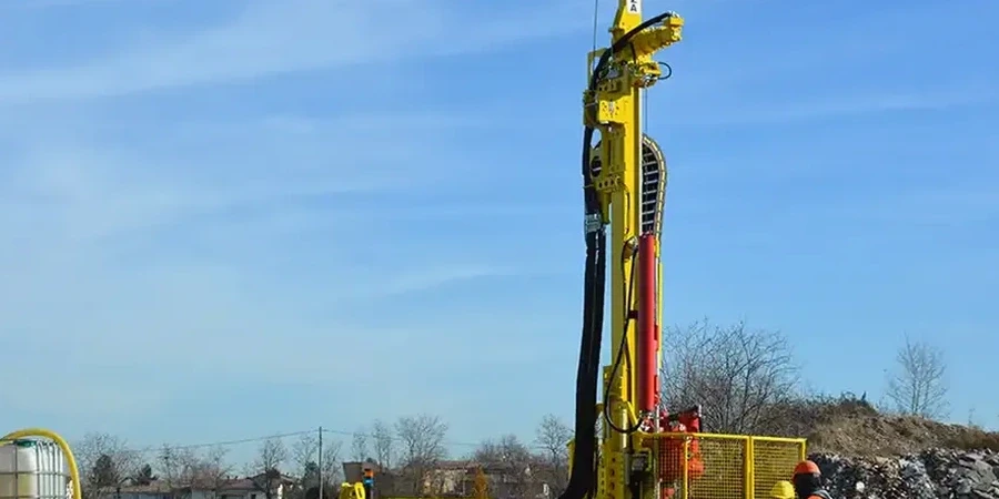
Waterford sits on a mix of compact glacial till overlying Ordovician shales and sandstones, with the River Suir carving through the city center. We have seen N-values swing from single digits in soft alluvial pockets near the Quays to refusal above 50 blows within three meters on the elevated northern terraces. That variability is exactly why the standard penetration test remains the most requested parameter in our local site investigations. A single CPT test might give you a continuous profile in the river silts, but when we need a soil sample to check the fines content of a weathered shale, the split-spoon sampler on the SPT rig is what gets the job done. With over 50,000 people and growing commercial development along the Cork Road, getting the bearing stratum wrong is not an option. We run every SPT in strict accordance with IS EN ISO 22476-3, using calibrated automatic trip hammers so the energy ratio is consistent from borehole to borehole.
In Waterford, the SPT is our first line of defense against the surprises buried in glacial and estuarine ground—no other test gives you a number and a sample in the same run.
Technical details of the service in Waterford
Local geotechnical conditions in Waterford
The biggest headache in Waterford is the buried soft layer—we hit a lens of compressible peat or silt at five meters when the top three meters were stiff boulder clay, and suddenly the foundation concept needs rethinking. SPT blow counts of zero to two in these pockets, often found near the old river channels south of the Tramore Road, signal potential differential settlement if the layer is not properly characterized. Pairing the SPT data with liquefaction screening is not academic in Waterford; the soft silts below the water table at about two to four meters depth can lose strength under the low-to-moderate seismicity we get from the Leinster Granite faults. We also watch for refusal on boulders within the till—a single high blow count can be misleading, so we log the drilling action carefully. Ignoring the transition zones between the till and the bedrock is what turns an ordinary foundation job into a claims dispute.
Our services
Our SPT work in Waterford integrates directly with the lab and field services needed to turn blow counts into design parameters.
SPT with Laboratory Classification
We pair each SPT run with grain size and Atterberg limits testing in our accredited lab so you get both the N-value and full soil classification for every stratum.
Combined SPT and Rock Coring
When refusal occurs on shale or sandstone, we switch to rotary coring to log RQD and recovery—critical for piles socketed into the Ordovician bedrock common under Waterford.
SPT for Liquefaction Assessment
In the silty floodplain deposits, we run SPT at closer spacing to feed into Seed-Idriss or Boulanger-Idriss analyses, giving your structural engineer the cyclic resistance ratio for seismic design.
Questions and answers
What is the typical cost for an SPT borehole in Waterford?
For a single SPT borehole to 10 meters depth in typical Waterford ground conditions—glacial till over rock—the cost ranges from €450 to €680, including mobilization within the city, the driller's time, and a factual report with corrected N60 values. If we need multiple boreholes, traffic management on narrow quayside streets, or deeper rock coring, the price adjusts accordingly. We provide a fixed quote after reviewing the site location and access constraints.
How do you correct the SPT N-value for Waterford's soil conditions?
We correct the raw blow count to N60 by normalizing for the hammer energy ratio we measure on-site, then apply overburden correction following the Liao and Whitman method. In Waterford's silts below the water table, we also adjust for the reduced rod energy in deep, wet holes. The final N1(60) value is the number we report for liquefaction analysis and bearing capacity calculations.
Can the SPT distinguish between natural ground and fill in Waterford's older industrial areas?
Yes—the drilling action and the SPT blow count profile reveal the fill boundary clearly. In the former gasworks site and older docklands, we often see low, erratic N-values down to two or three meters with brick fragments and ash in the sample, followed by a sharp increase in blow count when we enter natural alluvium or till. We log the material from the split-spoon carefully so the structural engineer can decide whether to remove the fill or design through it with a ground improvement strategy like stone columns.