Waterford's topography presents a quiet challenge that many developers only recognize once earthworks begin. The city straddles the River Suir, where steep valley sides are underlain by glacial till and weathered Ordovician shales. These materials hold up well in dry conditions but lose strength rapidly when saturated. The slope failures we see in the Ferrybank and Gracedieu areas usually trace back to pore-water pressure buildup after prolonged rain, a pattern that repeats every winter. A proper slope stability analysis quantifies that risk before excavation starts, factoring in the low shear strength of the till and the dip of the underlying bedrock. In our experience, the difference between a stable cut and a costly slip often comes down to understanding this specific geological sequence.
A stable slope in Waterford is rarely about rock strength alone — it's about managing water before the water manages the slope.
Technical details of the service in Waterford
Key parameters we evaluate include:
- Effective cohesion and friction angle from drained triaxial tests on undisturbed samples
- Pore-water pressure distribution under design storm conditions
- Bedrock dip angle and its influence on potential translational failure
- Unit weight of the saturated till, which can exceed 21 kN/m³
- Root cohesion contribution on vegetated slopes, a factor often underestimated in urban sites
Local geotechnical conditions in Waterford
A few years ago we reviewed a site off the Dunmore Road where a builder had cut a near-vertical face into the till, assuming it would stand unsupported through the winter. By February, a section roughly twelve meters wide had slumped, taking out the site access and delaying the project by seven weeks. The root cause was straightforward: the cut intercepted a perched water table that nobody had identified during the desk study. The remedial works involved regrading the slope to a 1:2 angle and installing horizontal drains, but the cost and program overrun far exceeded what a pre-construction stability analysis would have required. Scenarios like this are not unusual in Waterford's drumlin and river-valley terrain, and they reinforce why we treat slope stability as a front-end design task rather than a reactive fix.
Our services
Our slope stability work in Waterford typically integrates with other geotechnical services to build a complete picture of the ground. The three services below represent the most common combinations we deliver for residential developments, road widening schemes, and riverbank stabilization projects across the city and county.
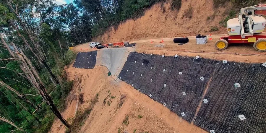
Stability assessment for cuttings and embankments
We evaluate proposed cut and fill slopes using site-specific soil parameters, groundwater monitoring data, and limit equilibrium software. The output is a design factor of safety that satisfies the requirements of the Irish National Annex for both short-term and long-term conditions.
Slope instrumentation and monitoring
For existing slopes showing signs of movement or for high-risk excavations near occupied structures, we install inclinometers and piezometers. Regular readings allow us to track deformation rates and pore-pressure trends, giving early warning before a failure develops.
Remedial design for failed slopes
When a slope has already moved, we investigate the failure mechanism through back-analysis and design remedial measures. These can include regrading, subsurface drainage, soil nailing, or retaining structures, depending on the space constraints and the geology at the site.
Questions and answers
What triggers slope failures in Waterford's soils?
The most common trigger is prolonged rainfall that saturates the glacial till and raises the groundwater table. This reduces the effective stress and, consequently, the shear strength of the soil. Human factors such as unplanned excavations at the toe of a slope or poor drainage detailing also contribute significantly to failures we investigate.
How much does a slope stability analysis cost for a residential site?
For a typical single-dwelling site in Waterford, the analysis generally falls between €1,040 and €3,840 depending on the complexity of the ground profile, the number of sections to be analyzed, and whether additional site investigation data is required. A fixed price is provided after we review the site topography and available ground investigation information.
Do I need a slope stability analysis for a small extension?
If your extension is on or near a sloping site, particularly in areas like Ferrybank or along the Suir valley, we recommend at least a desktop assessment. Even small excavations can destabilize a slope if they remove toe support or intercept groundwater flow paths. The cost of an analysis is modest compared to the expense of repairing a slip.
What software do you use for the analysis?
We use industry-standard limit equilibrium software that supports Spencer, Morgenstern-Price, and Bishop methods. The choice of method depends on the slope geometry and the failure mode being assessed. For complex three-dimensional geometries or where soil-structure interaction is critical, we complement the analysis with finite element modelling.
How long does the analysis take from start to finish?
Once the ground investigation data is available, a standard slope stability analysis can be completed within one to two weeks. This includes the development of the ground model, selection of design parameters, computation of factors of safety for various scenarios, and preparation of a report with clear recommendations. More complex sites with multiple cross-sections or staged construction may require additional time.