The application of Atterberg limits in Waterford requires strict adherence to IS EN ISO 17892-12:2018, a standard that governs the determination of liquid and plastic limits for fine-grained soils. Waterford’s geological profile, shaped by the River Suir and its tributaries, presents a complex sequence of estuarine alluvium overlying glacial tills. These soft, often compressible clays demand precise classification because their plasticity characteristics directly influence bearing capacity calculations for shallow foundations. When moisture content fluctuates—a common occurrence in Ireland’s temperate maritime climate—the behavior of these cohesive soils can shift dramatically from a solid to a plastic state, making the grain-size analysis a necessary complement for a complete gradation curve, particularly when silt percentages are elevated.
A single-point liquid limit determination without a full plasticity index curve often masks the true behavior of sensitive Irish silts, leading to underestimated consolidation settlements.
Technical details of the service in Waterford
Local geotechnical conditions in Waterford
The alluvial clays underlying the low-lying areas west of Waterford city centre, particularly near the former marshlands, are known to contain organic content above 2%, which can depress the liquid limit and produce a misleadingly low plasticity index if not accounted for. Classifying these deposits using Atterberg limits without a parallel loss-on-ignition test risks misidentifying a highly compressible organic silt as a lean inorganic clay. This misclassification has consequences: a foundation designed for inorganic soil may experience differential settlement exceeding 25 mm, cracking masonry and distorting door frames. The Casagrande chart is only as reliable as the data fed into it, and in Waterford’s estuarine environment, where porewater chemistry can flocculate clay particles and alter plasticity, the test must be performed on fresh samples within 24 hours of extraction to preserve the in-situ moisture regime.
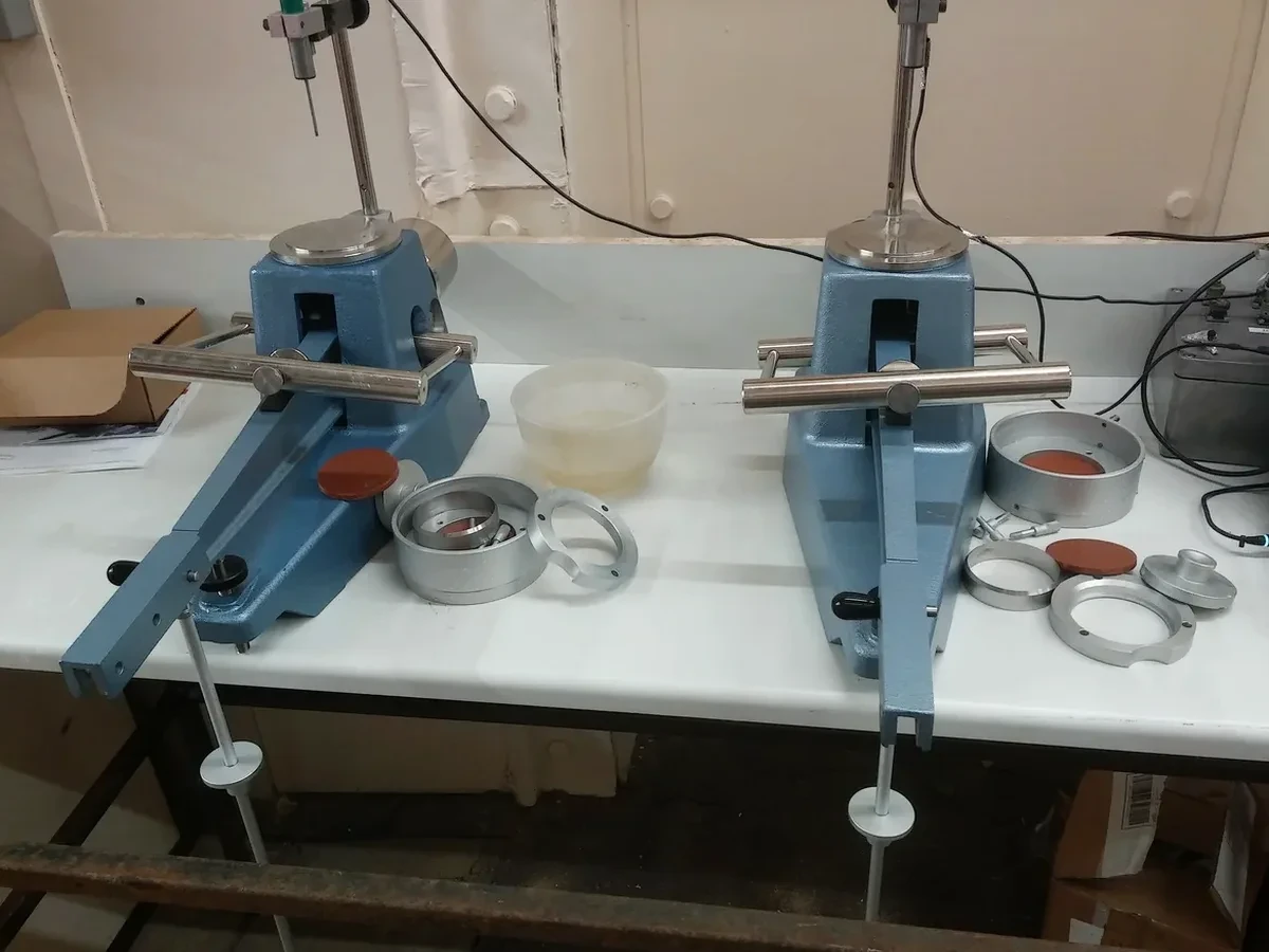
Our services
Our laboratory in Waterford processes cohesive soil samples for classification projects ranging from single-house extensions to multi-storey apartment blocks along the quays. The three core testing packages integrate Atterberg limits with complementary index testing to meet the requirements of the Building Control Amendment Regulations (BCAR).
Full Atterberg Suite
Liquid limit by fall cone, plastic limit by thread rolling, and natural moisture content. Includes plasticity index calculation and Casagrande chart classification. Report ready in 3 working days.
Moisture Condition Value (MCV)
A rapid assessment for earthworks acceptability, correlating undrained shear strength with Atterberg-derived liquidity index. Used extensively for road subgrade evaluation on County Waterford infrastructure projects.
Linear Shrinkage & Swell Testing
Measures the one-dimensional shrinkage strain of remoulded soil. Recommended for brownfield sites in Waterford where clay desiccation has occurred prior to redevelopment.
Questions and answers
How much does an Atterberg limits test cost in Waterford?
The standard suite including liquid limit, plastic limit, and natural moisture content ranges from €70 to €110 per sample. The final cost depends on the number of samples and whether additional tests like particle size distribution or organic content are required. We provide a fixed-price quotation based on the site investigation scope.
What is the difference between the Casagrande cup and the fall cone method?
The Casagrande cup measures liquid limit by counting blows to close a groove under dynamic loading, while the fall cone method measures static penetration depth of a standard cone. The fall cone method, preferred in BS EN ISO 17892-12, yields more reproducible results for sensitive Irish silts and clays because it eliminates operator variability in groove cutting and blow rate. Both are accepted, but we default to the fall cone for Waterford projects.
Can Atterberg limits be tested on samples with sand content?
The test applies only to the fraction passing the 425 µm sieve. If your Waterford sample contains significant sand or gravel, we first wet-sieve the material and perform the Atterberg limits on the fine fraction. The percentage retained on the sieve is reported separately. For soils with over 50% sand, the plasticity index may be inflated due to the reduced clay fraction, and we recommend correlating results with a full particle size distribution.